Low-flying aircraft to resume scanning land over Munster

As part of a nationwide programme of the Geological Survey Ireland, The Tellus Survey is resuming its flights for 2019 over land in Limerick, north Tipperary and west Cork.
The purpose of the survey is to collect geochemical and geophysical data on rocks, soil and water across Ireland.
According to a Government statement, the low-flying aircraft will be flying over land to record data over the next few months.
If farmers have any concerns and would like to be kept informed they are advised to call the helpline
The aircraft is equipped with scientific instruments to measure variations in the Earth’s magnetic field, the conductivity and natural radioactivity of rocks and soil.
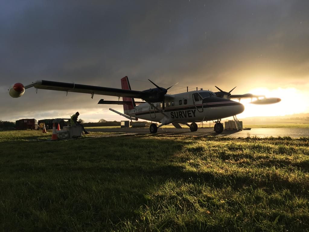
The aircraft is a white, twin propeller plane, which can be identified by its red tail and black stripe as well as the word ‘SURVEY’ and registration number C-GSGF written on both sides of the plane.
60 meters above farms
Based at Kerry airport, the plane will be flying at an altitude of 60m above rural areas as approved by the Irish Aviation Authority.
Commenting on the mission, Dr. James Hodgson, senior geologist and project manager for Tellus, said: “The data collected from the survey will help to sustainably manage the environment, natural resources and protect public health in the future.”
Concluding, the statement said this all helps to provide a comprehensive picture of the overall environment within Ireland.
Data collected throughout the Tellus project is published and made available on the Tellus website.