GNSS could bring more accuracy to machinery implements

Global Navigation Satellite Systems (GNSS, often referred to as GPS) are usually considered the preserve of experts equipped with a specialist knowledge, that is beyond the farmer and stretches the capability and budgets of many smaller manufacturers.
This situation is starting to change - just as creating websites came down from the clouds and was made a possibility with any device connected to the web, GNSS too will become available to a much wider audience.
GNSS made easy
This is the ambition of Septentrio, a Belgian company that has been producing both the hardware and software for GNSS equipment worldwide.
As always with statements from digital tech companies, the actual intent of their latest products is shrouded in a mist of jargon and acronyms, yet sometimes it is worth penetrating the soup to discover just what is being achieved.
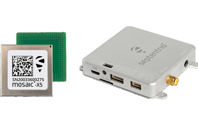
In this case it appears that Septentrio, which already produces the internal electronic components (referred to as boards) for GNSS receivers, have created a reference design of software which will enable "easy plug and play sensor integration" for an established electronics standard already widely used in the GNSS developer community.
This is being launched as open source software, allowing developers to fine tune it for each particular application, rather than relying on expensive coding that tries to do everything, or hiring in consultants.
It has called this software MosaicBus and the overall aim is to simplify the development of the GNSS component of machinery electronics, and to reduce their time to market.
Adding functionality
The second development is a carrier board with the GNSS receiver software already embedded. It is intended to be used with the Portenta machine control unit from Arduino, adding GNSS capability to its functions.
This means that a widely used computer in industry, the Arduino Portenta, which controls automated machinery, may have GNSS capability added more easily, encouraging its use outside in the field.
Much of this will sound rather esoteric to those not involved in the digital tech community, yet the gist of it is that GNSS tracking will, hopefully, become easier and therefore cheaper, to install on all machines.
Practical application
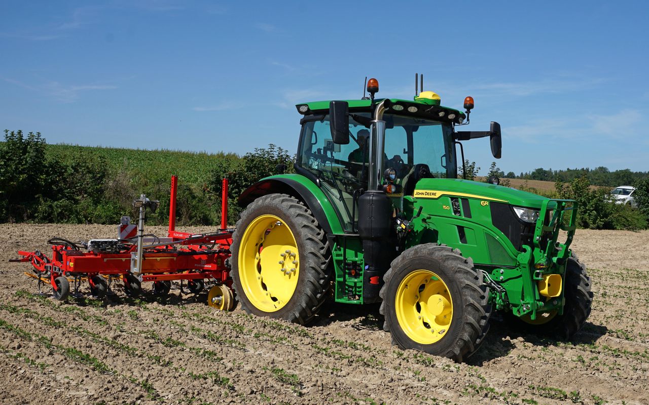
This widens the scope of what may be done with satellite navigation and it will help move it to implements in addition to just tractors.
One situation where this may be of practical use is on interrow hoes which run behind the tractors and are sited away from the main antenna, resulting in a loss of the necessary accuracy.
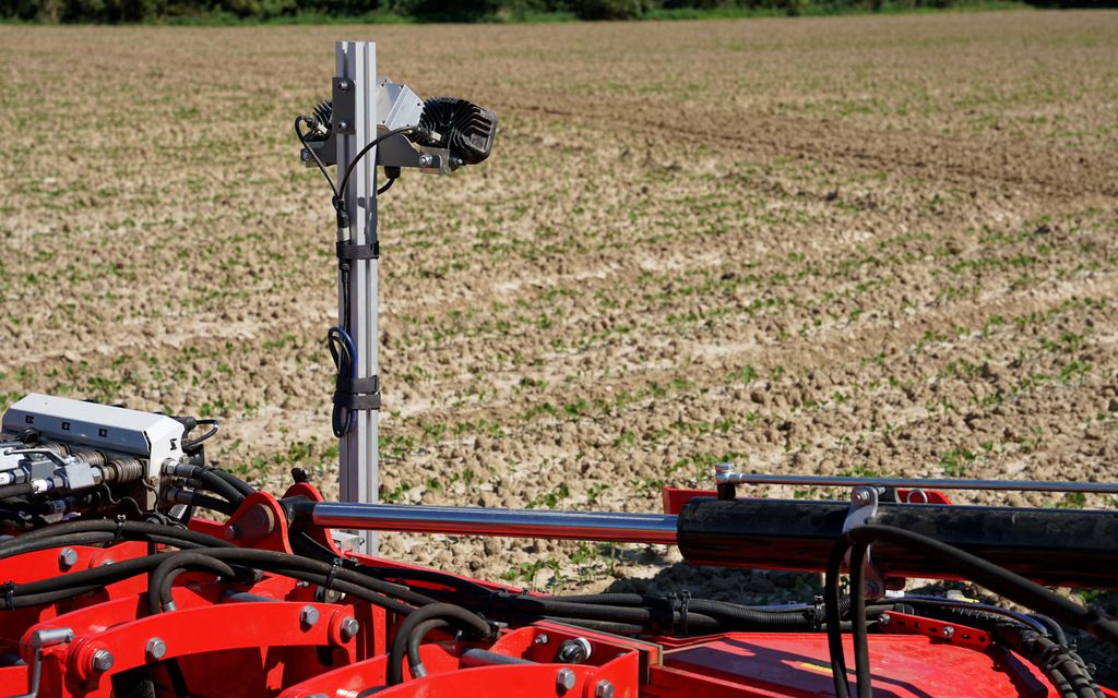
So far the answer has been camera guidance with row detection software altering the position of the hoe relative to the tractor; fitting a GNSS receiver to the implement may well overcome the need for cameras and expensive software.
Just as a footnote, there is a growing number of satellite constellations used for navigation.
The original was the American GPS (Global Positioning System) and this has become a generic term for all systems, much like JCB and Hoover.
The term GNSS refers to any satellite navigation array.