Midland Weather Channel issues thunderstorm alert


A weather channel focused on the midlands has issued a thunderstorm alert for certain areas of the country to arrive into the early afternoon.
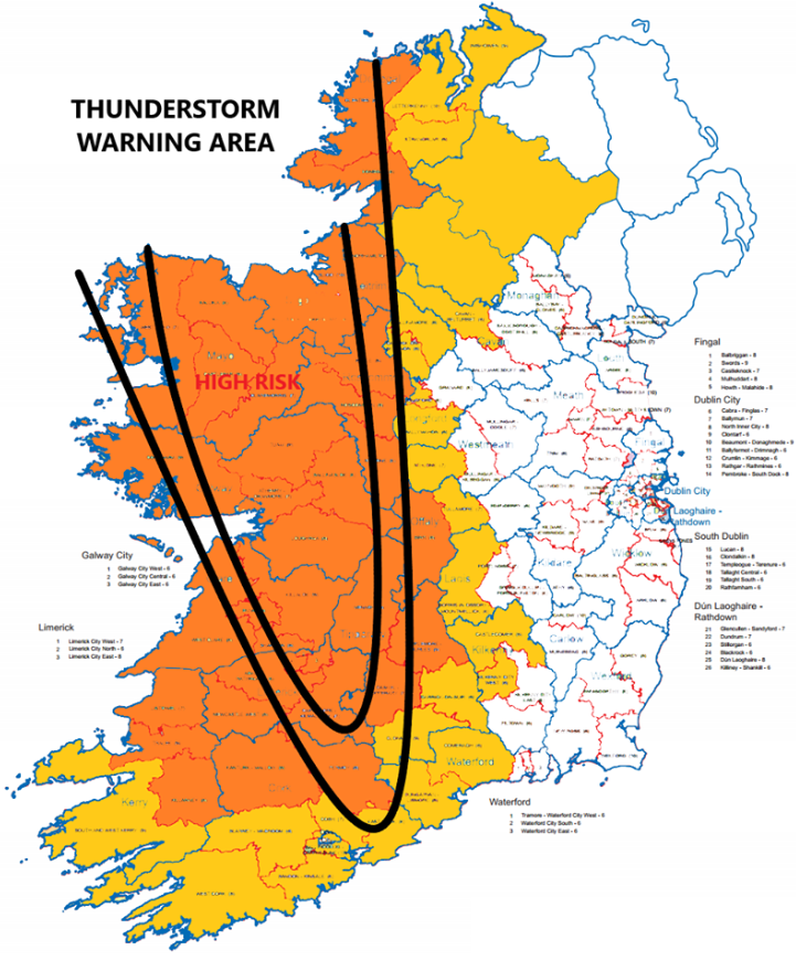
Midland Weather Channel took to Facebook to warn members of the public of a weak cold front that currently lies across the southwest of the country.
The forecaster outlined that this, combined with very warm air, as well as strong surface heating and increasing instability in the atmosphere, “creates the risk for some potentially severe thunderstorms to develop”.
However, not all areas will experience these storms. The forecaster explained: “Indeed most areas of the country will remain dry, bright and sunny, with temperatures again ranging into the high 20s.
Areas that do experience such storms are at risk of frequent lightning, hail, and some isolated spot flooding as a significant volume of rainfall is possible in a rather short period.
Concluding, the forecaster noted that predicting the exact location is always a tricky science and therefore it’s advised to keep up to date with the very latest forecasts throughout the course of the day.
Midland Weather Channel has said it is “dedicated to forecasting weather conditions across Laois, Offaly, Westmeath, Longford, Roscommon, east Galway and Kilkenny”.