Met Éireann issues further rain warning as wet weather continues


Met Éireann has issued a further Status Yellow warning for rain which will effect some eastern counties and Co. Kerry for most of today (Friday, October 20), with wet weather set to continue.
A Status Orange rainfall warning for Dublin and Wicklow is currently in place and will remain valid until 8:00a.m on Saturday.
A Status Yellow rain warning is currently in place for counties Cork, Kerry, Limerick and Waterford, and will remain in place until 9:00a.m.
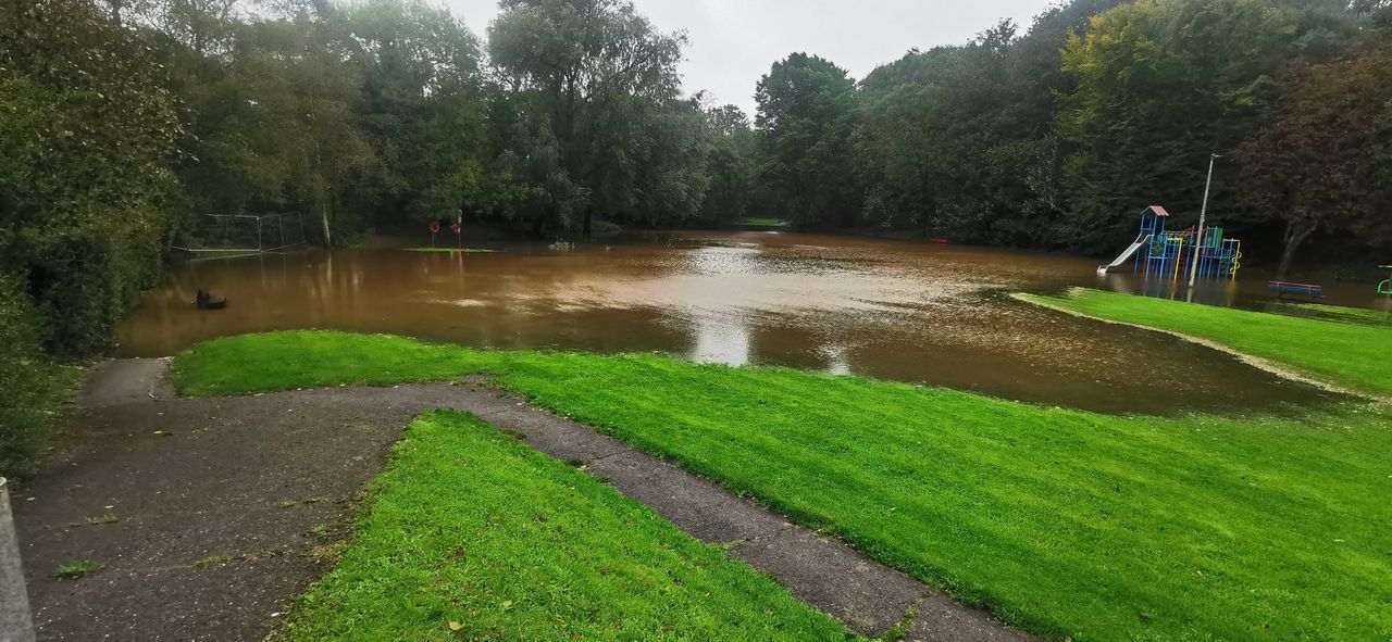
These counties will see heavy bursts of rain this morning, coupled with waterlogged soils and high river levels, which are likely to lead to further localised flooding and dangerous travelling conditions.
A Status Yellow rain warning has also been issued for counties Dublin, Louth, Meath, and Wicklow, as well as Co. Kerry.
These counties will be under the warning from 9:00a.m for 12 hours, until the warning expires at 9:00p.m.
These counties will see heavy rain or showers with a chance of thunder. Localised flooding and dangerous travelling conditions are possible.
In general nationwide today, slow moving downpours in parts of the west and southwest will ease for a time with some brighter spells, but rain will linger near some coasts.
Heavy spells of rain over Ulster will spread into north Leinster this morning and other areas during the afternoon and early evening, which will be heavy at times with some localised flooding possible, according to Met Éireann.
Some drier, brighter spells will return to the north by the end of the day. Afternoon temperatures will be 10 to 15 degrees, coolest in northern areas. There will be strong and gusty winds in the east, north and far southwest. Winds will be lighter in other areas.
Outbreaks of rain will gradually clear south overnight, with drier and cooler conditions spreading from the north. Lowest temperatures overnight will be 4 to 8 degrees in a moderate to fresh north to northeasterly breeze.
Tomorrow (Saturday, October 21) will be a day of bright spells and some scattered showers or patchy rain in parts. However, there will be a lot of dry weather for many. Maximum temperatures are expected to be 10 to 12 degrees in a moderate north to northwesterly breeze, decreasing to light.
At the moment is looks set to be dry for many on Sunday (October 22), with plenty of sunshine and just the odd passing shower. However, during the late afternoon and the evening some showery rain is expected to spread into the west and south which could turn heavy or thundery in places.
Highest temperatures on Sunday are expected to be 11 to 14 degrees in light to moderate, variable or southeasterly winds.
Showers, or longer spells of rain, heavy or possibly thundery in parts, will affect Munster and parts of Connacht and Leinster on Sunday night with the chance of localised flooding in places. It will hold drier elsewhere with some scattered showers. Winds will be light with some mist and fog.
Further pulses of heavy, possibly thundery, rain are expected to feed up over Ireland on Monday (October 23), with some localised flooding possible as a weather front stalls over the country.
There will be some bright dry periods either side of the front. Highest temperatures will be 10 to 13 degrees.