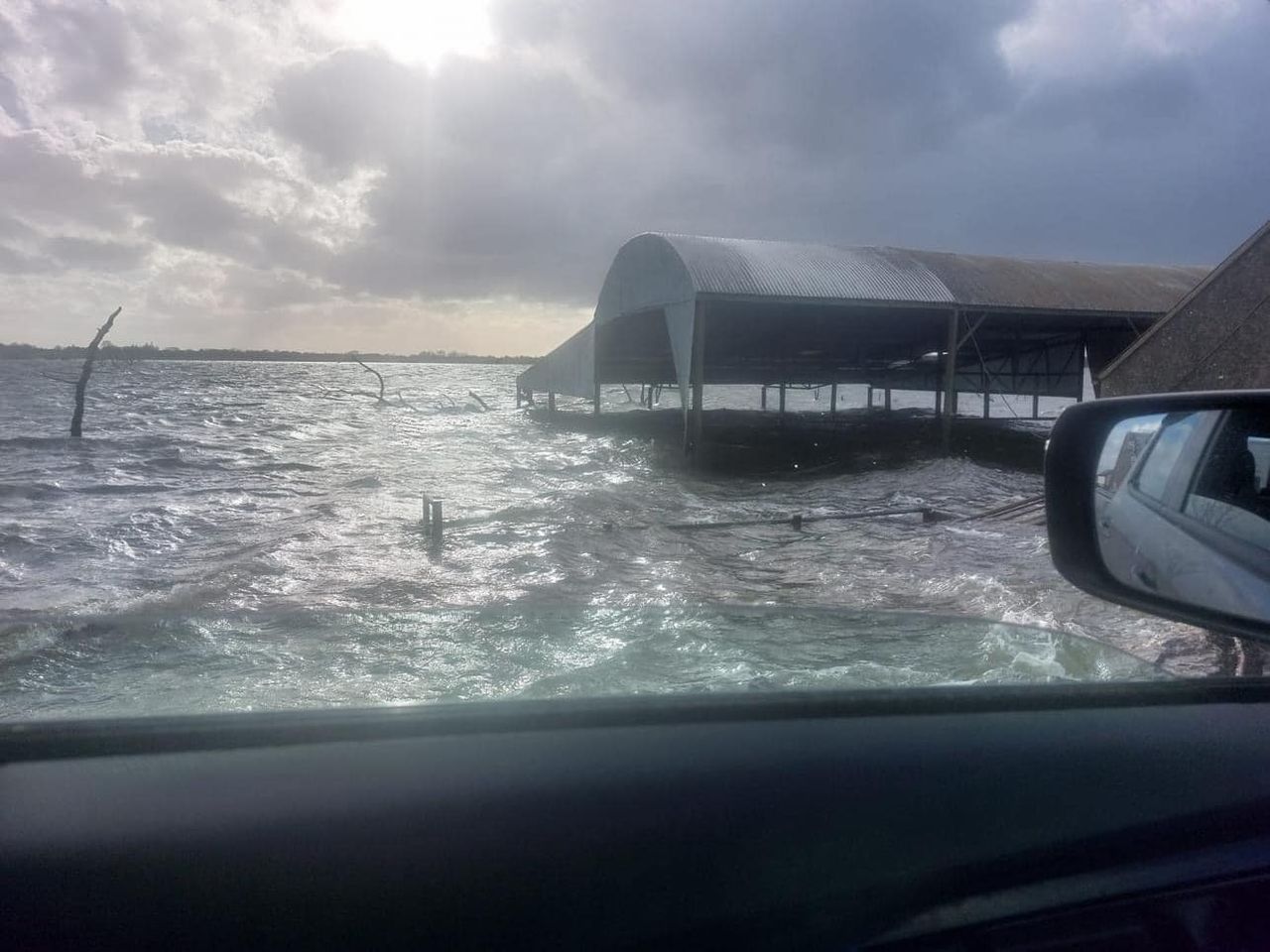
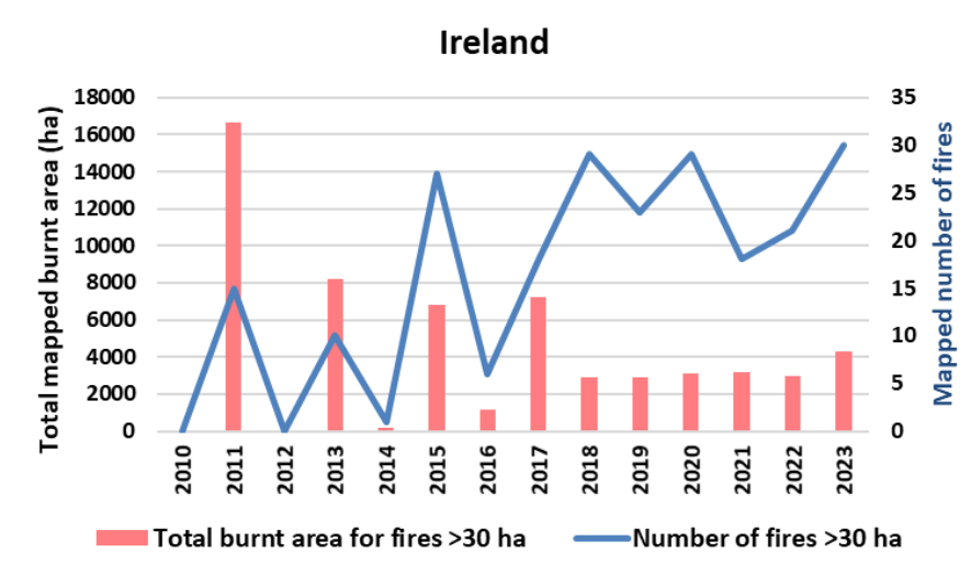
117 fires covering over 5,000ha mapped in Ireland in 2023

117 fires were mapped in Ireland in 2023, covering over 5,000ha, which is slightly above recent years, according to a EU Commission report published today (Wednesday, April 10).
The Advance report on Forest Fires in Europe, Middle East and North Africa 2023 reveals that the peak of the fire activity in the country was in February when over 3,000ha was burned.
The report, produced by the commission's Joint Research Centre (JRC) is based on data from the European Forest Fire Information System (EFFIS) which maps wildfires in Europe and the adjacent regions since 2000.
The commission said that around 36% of the burnt area (1,850 ha) was recorded in Natura 2000 sites.
Of the 5,203ha impacted by fires, 4,975ha was classified as "other natural land", 98ha was agricultural land and 92ha was transitional land.
28ha of coniferous forest was burned, while 4ha of broadleaf forestry and 1ha of mixed plantation was also hit by fires.
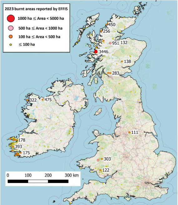
A map produced in the report shows a concentration of larger fires located in the southwest of the country.
The Department of Agriculture, Food and the Marine (DAFM) previously confirmed to Agriland that it identified 665 herds associated with illegal burning in 2023.
The department said that these herds either had lands burnt in the closed period or at the correct time of year, but without the relevant consent.
Fires
The commission report states that the 2023 wildfire season was among the worst ever recorded in the European Union.
In total, over half a million hectares, an area twice the size of Luxembourg, was scorched last year.
The report shows that 37% of the total burnt area in 2023 was covered by shrubs and sclerophyllous vegetation, while 26% (120,000 ha) were forests.
The wildfires produced 20 megatonnes (Mt) of carbon dioxide (CO2) emissions, which is equivalent to nearly a third of all emissions from international aviation in the EU in one year.
The 2023 fire season started with more fires in February and March than is usual, resulting in over 100,000ha burnt in the EU.
Wildfire activity peaked in the summer months, when fire danger conditions became critical in the Mediterranean region.
By the end of the year, the extent of the burnt area mapped by EFFIS reached 504,002ha, behind 2017 (988,427ha), 2022 (837,212 ha) and 2007 (588,388 ha), the three worst years this century.
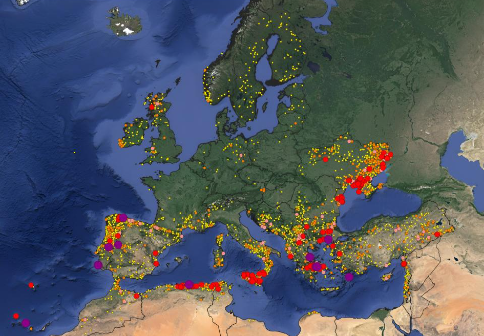
Greece suffered the largest single fire to occur in Europe since the 1980s during last summer.
The EU Commission said that climate change is making wildfires more and more frequent.
Preliminary data for the first three months of 2024 shows almost double the average number of fires, although these did not have major impact in terms of burnt areas.
In March, the commission published a communication on climate resilience in the EU and effectively managing climate risks.
As part of immediate action, the measures call for enhanced prevention including nature-based solutions, better preparedness thanks to early warning systems and efficient firefighting means made available through the EU Civil Protection Mechanism (UCPM).