Met Éireann: Showery conditions for Easter weekend

Met Éireann has said that the unsettled showery weather conditions are set to continue over the Easter weekend across the country.
The national forecaster said that there will be a cold and frosty start today (Friday, March 29) with sunny spells and scattered showers, mainly in the south.
Cloud will thicken during the afternoon and showers will become more widespread, some will be heavy and fall as hail.
There will be highest temperatures of 8° to 12°C in light to moderate southerly winds.
It will be mostly dry tonight apart from some isolated showers, some frost is possible as temperatures fall back to between -2° and 4° in light to moderate southerly winds.
Weekend
Saturday (March 30) will be mostly dry with sunny spells but blustery showers will move northwards as the day progresses, some will be heavy with hail.
The southerly winds will be strong at times in the southwest, moderate to fresh elsewhere, with highest temperatures of 9° to 12°.
There will be a mixture of clear spells and showers on Saturday night, rain will develop in the south later and extend northwards. Overnight temperatures of 3° to 7° in light to moderate southeasterly winds.
Easter Sunday (March 31) will be cloudy with showers, some brighter conditions will develop during the afternoon with sunny breaks possible. It will feel milder than previous days with highest afternoon temperatures of 10° to 13° in light to moderate southeasterly winds.
Showers or longer spells of rain will arrive in Munster and Connacht on Sunday night with isolated showers elsewhere. Lowest temperatures of 2° to 6°.
Easter Monday (April 1) will be wet in the south and west, drier and brighter weather in the east and north, with isolated showers. Highest temperatures of 9° to 13°.
Tuesday (April 2) will be dull and wet with rain in the south and showers elsewhere, highest temperatures of 7° to 12°.
Current indications suggest that the unsettled conditions will continue next week and the colder temperatures may return.
Met Éireann
The week ahead will be wetter than average across the majority of the country with 20-30mm expected widely, with up to 50mm likely in some southern areas.
Mean air temperatures will be near or slightly below average over the coming week. Soil temperatures will decrease somewhat, but will still be slightly above average.
Drying conditions will be generally moderate or poor as any dry spells will be short, opportunities for spraying will be limited due to breezy and wet conditions.
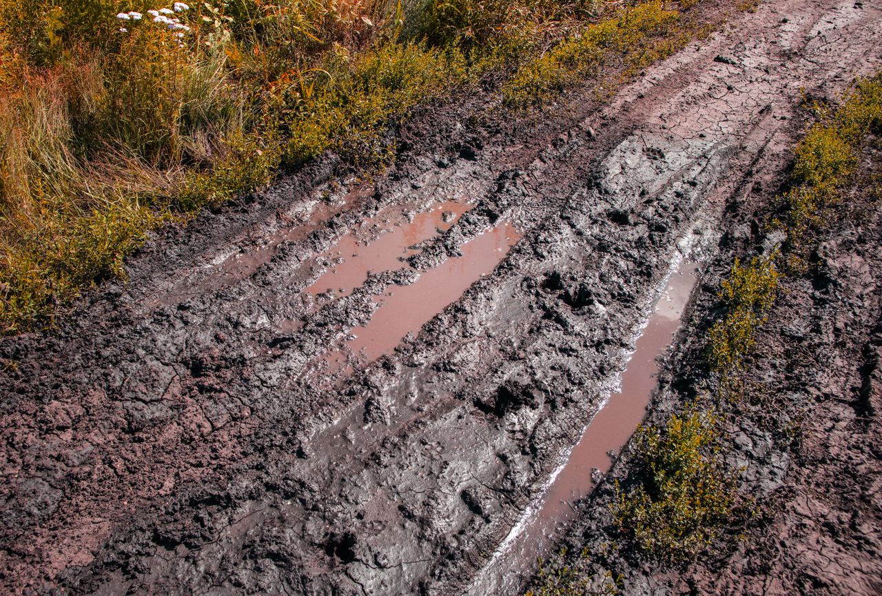
Met Éireann said that all soils are currently saturated and poorly drained soils are waterlogged.
Further rainfall is expected over the coming week, but a slight improvement is expected with some light soils trafficable by the end of the week.