Flood warnings on Rivers Shannon, Barrow, Nore and Slaney
Rivers are badly swollen and flooding is likely over the next couple of days. This is according to the National Co-ordination Group, which met again today to discuss ongoing severe weather.
The group says foretasted rain is likely to top up the already near capacity of Ireland’s main rivers and this poses a major risk. It says this risk is heightened in slow-moving rivers. It said particularly the Shannon, the Barrow, Nore and Slaney are also at very high levels and any additional rain may cause serious flooding.
The meeting, which took place today at the National Emergency Co-ordination Centre, also reviewed the response to date, assessed the impact of the storms on infrastructure and communities.
The group advised that there is a body of information in relation to the levels of water in our major rivers on www.waterlevel.ie. There is also advice on how to deal with episodes of flooding on www.flooding.ie and the public are advised to check out these websites or to contact their local authority for further information.
It noted each storm and severe weather warning issued by Met Eireann is monitored for severe weather emergencies and contact is ongoing with Met Eireann, the local authorities and the transport and energy sectors. Local authorities are also on high alert and are planning and making the necessary preparations for further flooding, it added.
The group thanked the emergency services, local authority workers, state agencies, businesses and the public for their hard work and patience during the recent event.
The committee chairman, Sean Hogan, also requested that the public would continue to heed the safety warnings of the authorities, and noted that fortunately there have been no fatalities in the current flooding episodes.
The co-ordination group will meet again tomorrow and a further update will issue following that meeting.
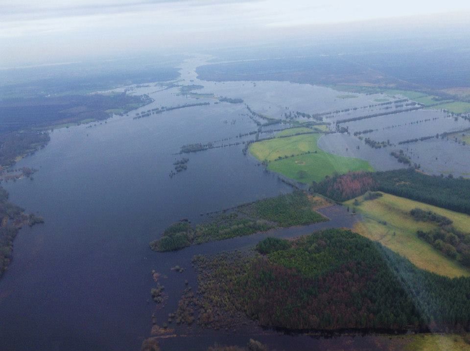
An aerial view of the Midlands taken by the Irish Air Corps earlier this week shows the extent of the flooding at Ballinasloe and Athlone. (Irish Air Corp Facebook page)