Weather: Cold spell to continue with mixed conditions

The weekend is set to remain cold, with mixed weather conditions remaining, and turning cloudier early next week, according to Met Éireann.
A cold weather advisory, which Met Éireann issued last weekend and which was due to expire at around 10:00p.m tonight (Friday, January 12), has been extended to 9:00a.m tomorrow (Saturday, January 13).
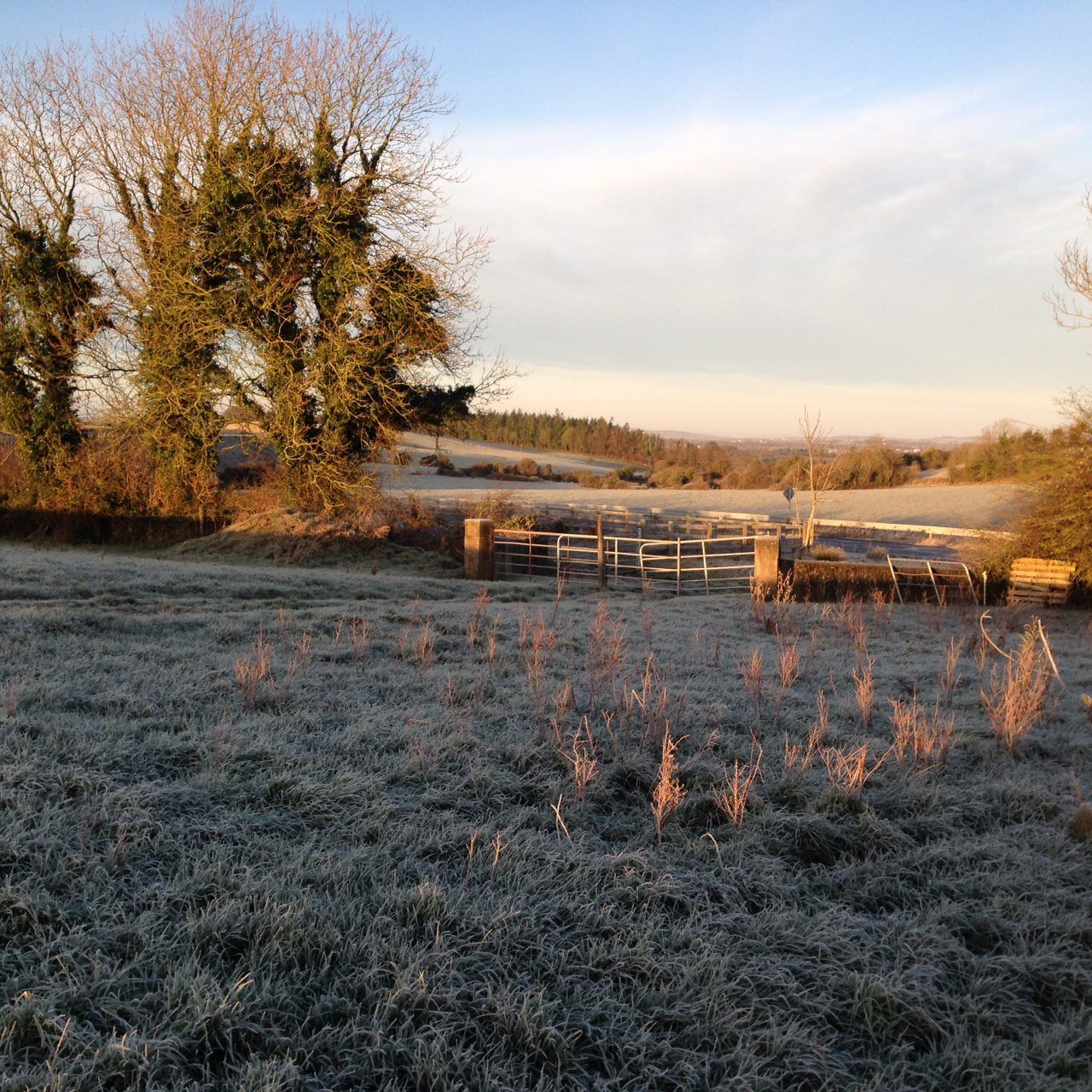
Met Éireann said it will stay cold nationwide, with widespread frost and icy patches, leading to hazardous weather for travelling.
Today will be a mostly cloudy and dry day, with any frost, ice, and fog clearing through the morning. There'll be some limited bright or sunny spells. Highest temperatures will be 4° to 7° in light northeast or variable breezes.
It will be calm and dry tonight with frost setting in early. Lowest temperatures will be -2° to +2°, coldest in Munster and Leinster where some clear spells are expected.
Tomorrow will be mostly dry with occasional sunny spells for the morning, with a little drizzle possible near the south coast. Patches of light rain or drizzle will move down into northern parts during the afternoon and evening.
Highest temperatures will be 3° to 7°, coldest in the south, in a light and variable breeze.
Patchy light rain or drizzle will continue sinking southwards over tomorrow night, with clear spells following in the north later. It will be cold and frosty, with lowest temperatures of -3° to +2°.
Sunday (January 14) will see a mix of sunny spells and cloud to start with patches of light rain or drizzle. It will brighten up with further sunny spells developing through the day, with just isolated showers. Highest temperatures are expected to be 4° to 7° in a light to moderate northerly wind.
Sunday night will be very cold with clear spells and widespread frost. Most areas will be dry but there will be isolated wintry showers, mainly feeding into northern areas on a light to moderate northerly breeze. Lowest temperatures will be around -3° to +1°.
Monday (January 15) will be cold with frost slow to clear. Most places will be dry and sunny but it will be cloudier in the north and west, bringing scattered wintry showers. Highest temperatures should be around 2° to 5° in a light northerly wind.
It looks like Tuesday (January 16) will be cloudier than previous days, with rain turning to sleet or snow at times over the northern half of the country. Highest temperatures are expected to be 3° to 7° with light to moderate southwest or variable breezes.