Unsettled weekend ahead with showers each day - Met Éireann


Met Éireann has forecast an unsettled weekend ahead, with rain or showers each day along with breezy conditions at times.
Today (Friday, June 5) will bring an improvement to most places for a time, as it will not be as showery or as breezy as of late.
There will be some sunny spells too for a while, with the best of these across the east and north and it will stay dry generally in the east.
However, there will still be scattered showers, especially further west and north.
Cloud will increase during the afternoon, and it will become wet and breezy across Munster through the evening, with rain moving up from the south-west, heavy later in the south and south-west.
Widespread rain
The rain will edge into southern parts of Leinster and southern parts of Connacht too before nightfall.
It will be cool for early summer with highest temperatures generally of 12° to 16°, maybe a little higher in parts of the east.
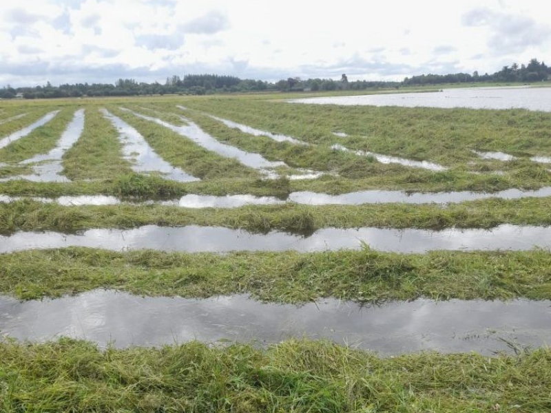
Tonight, rain will become widespread and will become heavy in places too, particularly in the south.
There will be some mist and hill fog too.
It will become breezy with the rain, with east to south-east winds increasing moderate to fresh and occasionally gusty, strong at times in some coastal parts.
Met Éireann forecast
There will be a cloudy and wet start to Saturday for most, with further outbreaks of rain, heavy in places for a while, before easing.
A clearance to mostly dry conditions with some bright or sunny spells will move into the south-west and west early in the morning, gradually extending elsewhere.
The last of the rain will clear from the east and north-east through the afternoon and early evening.
Cloud will build again in the west in the evening, with more rain and drizzle moving in.
There will be highest temperatures of 13° to 17° in mostly light to moderate cyclonic variable winds, fresh for a time in the east.
Saturday night will bring a good deal of cloud overall, with rain and drizzle, mainly for the south-west, west and north-west.
It will hold mostly dry elsewhere, with some clear spells for a time
Sunday will be cloudy in all areas with outbreaks of rain becoming widespread from the west through the morning, some of it heavy.
Sunshine and showers
Brighter conditions with sunshine and showers will move into western and north-western parts during Sunday afternoon, and slowly extend elsewhere.
Some of the showers may turn heavy later, especially in the north-west.
It will stay cloudy and wet well into the evening in the east and south-east.
There will be highest temperatures of 14° to 18° in moderate to fresh south-west winds.
Sunday night will bring a mix of clear spells and showers, with most of the showers in the west and north, some heavy.
Monday is expected to be a brighter day with sunshine and showers, some of them heavy.