Farmers in south-west warned of low-flying survey aircraft


Farmers in the south-west have been warned about a low-flying aircraft in the region over the coming months as part of a nationwide survey.
The Tellus survey is a national programme to gather geochemical and geophysical data across Ireland.
This enables scientists to examine the chemical and physical properties of soil, rocks and water.
Tellus is undertaken by Geological Survey Ireland and is funded by the Department of the Environment, Climate and Communications (DECC).
The information gathered will assist in the development of new geological maps and help the department to "make the best use of our environmental, agricultural and natural resources".
The information from the survey will be freely available to all members of the public.
Aircraft
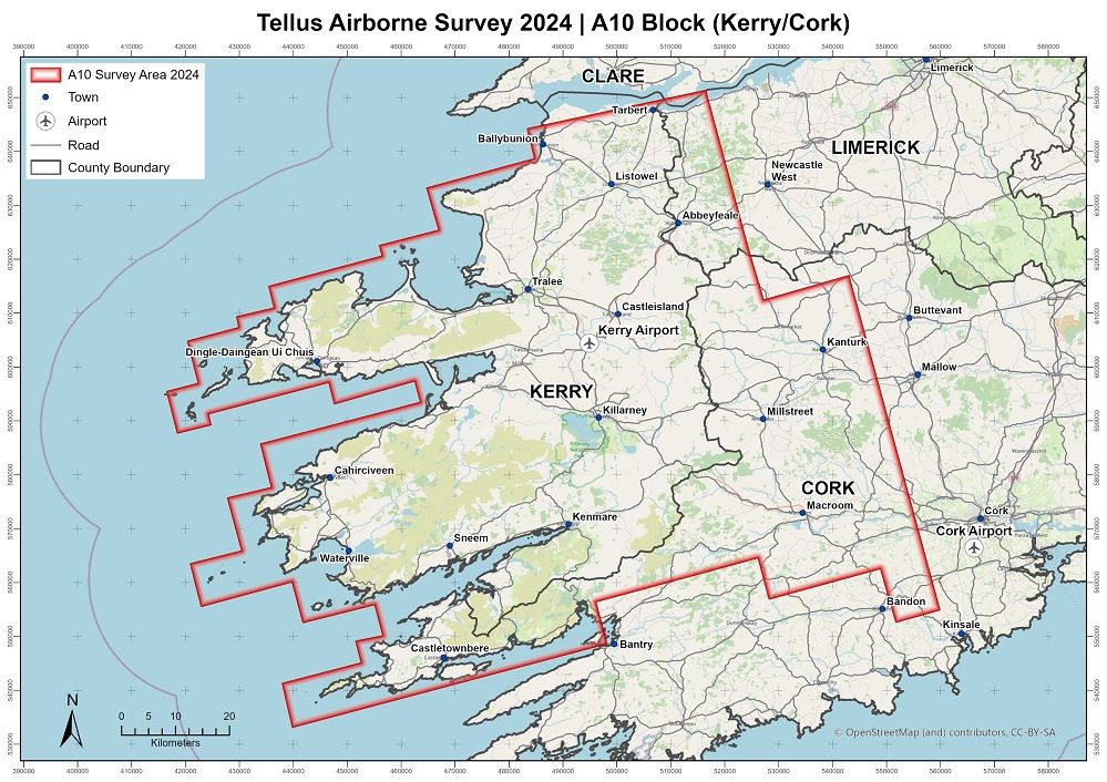
As part of the survey and to collect the necessary data an aircraft will fly at a low level across Kerry, northwest Cork and part of west Limerick.
The area to be covered by the airborne survey is outlined in the following map:
Geological Survey Ireland said that the survey will take place from late spring until autumn.
The flight schedule is weather dependent and is therefore subject to change.
The manned aircraft will fly at 60m over rural areas and will rise to 240m over urban locations.
The white, twin propeller plane has a red tail and a black stripe and is labelled "SURVEY" on the side.
Geological Survey Ireland said that the sound of the plane is similar to a passing lorry and it may startle more sensitive animals, such as horses.
Anyone who has concerns about livestock, or who operates a drone in the area covered by the survey can call 1800 45 55 65 to be kept informed of flight plans in their locality.