Detailed maps of preferred route for Galway greenway released

Detailed satellite maps of the preferred route for the new Galway to Athlone greenway have been published by the project team this week.
Landowners, farmers, cyclists and those in the wider community are now able to view in detail, exactly where the preferred route for the 205km stretch runs on the maps below.
They have also been invited to attend a number of public information evenings taking place across Galway this week, which will be attended by Senator Aisling Dolan and local councillor for the Gort Kinvara area Geraldine Donohue.
Speaking to Agriland, both Senator Dolan and Cllr. Donohue urged locals to come along, speak to them and the project team and raise any questions they may have.
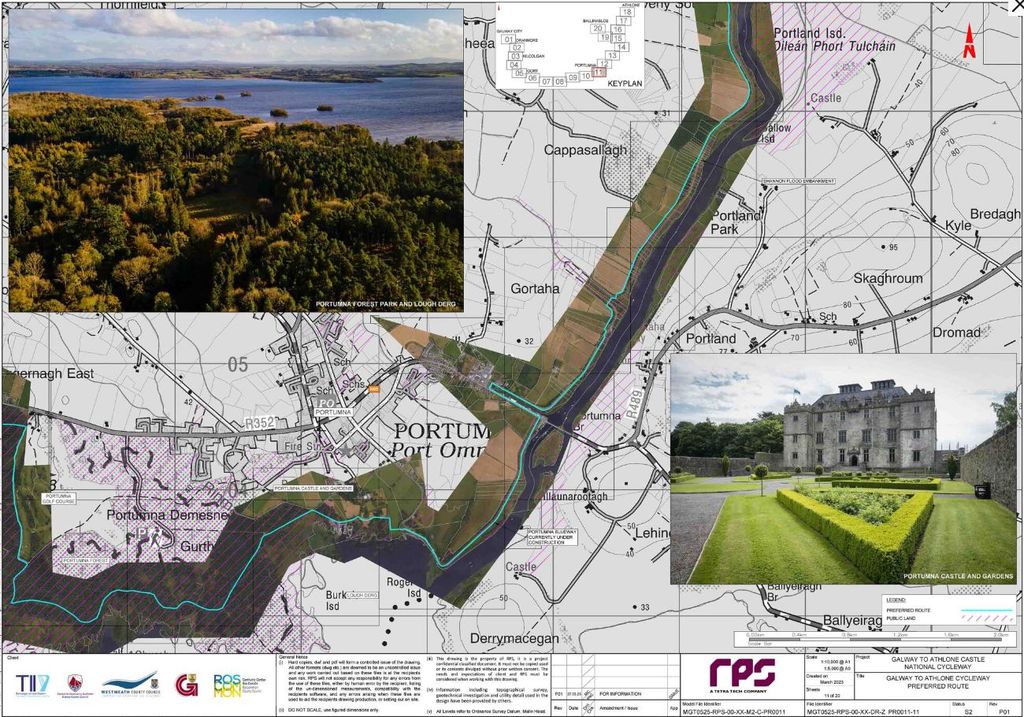
The aqua-coloured line in the images below traces the preferred route, and as can be seen in the maps, the route does pass through a number of fields and privately owned lands.
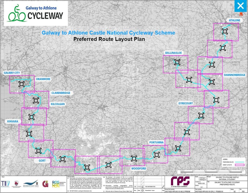
The map above has been broken down into 20 more detailed maps which you view closer up by clicking through the images in the gallery below.
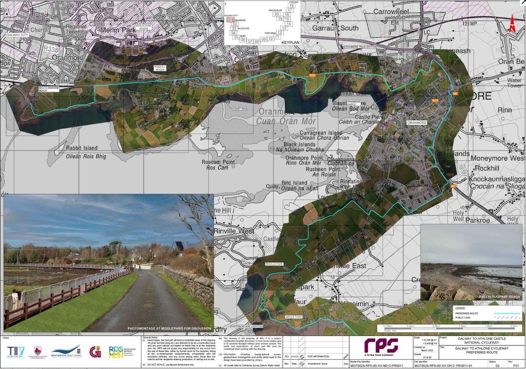
The maps above cover the area from the greenway's starting point at Ballyloughan Beach in Galway City to Portumna Demense, a stretch which passes through Oranmore, Clarenbridge, Kilcolgan, Kinvara, Gort, Bunaglass, Derrybrien south and Woodford.
The route then continues on through Portuma, Meelick, Kilmacshane, Eyrecourt, before splitting in two at the Clonfert/Coolcarta area.
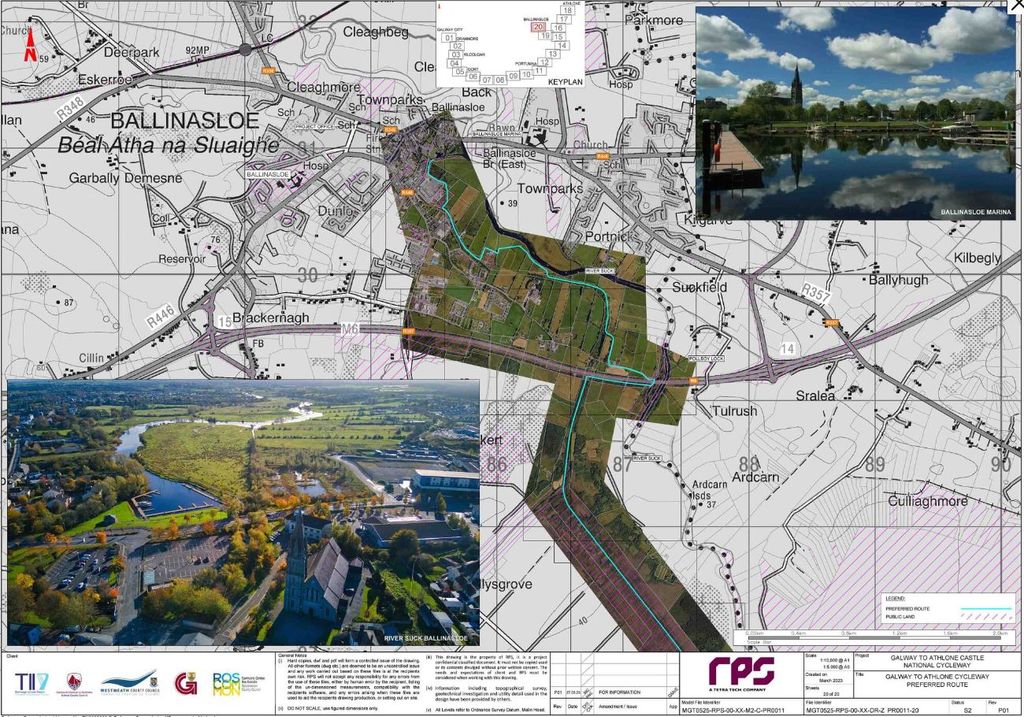
The main route will continue up towards Shannonbridge and then Athlone. Meanwhile, the offshoot route or the 'spur' will branch towards Ballinasloe. Details of both of these routes can be seen in the maps below.
The below images detail the preferred route for the cycleway spur that will branch off and lead towards Ballinasloe town.
The Galway to Athlone greenway has been a major cause of concern for a number of farmers who could see their land severed by the development, which they believe could lead to secondary challenges around business viability, anti-social behaviour, trespassing, and a lack of privacy.
In addition, a number of local landowners who may be impacted have told Agriland that they are aggrieved over the lack of communication from the project team throughout the process.
Cllr. Donohue told Agriland that many locals have been in contact with her to express their disappointment with the route.
"The 'preferred route' has been published but based on all the emails and calls that I have received I am not too sure who prefers it.
"I am against the severance of farms and asked that the cycleway skirt along the public road, massive margins in areas that could be utilised.
"[There are] genuine concerns from home and landowners and I hope that they will be listened to and respected by the project team," she added.
However, the project has stated that it has held numerous public consultations and has had "extensive engagement with landowners to address identified issues whilst ensuring continuity of the route".
It added that one-to-one meetings are the most beneficial for all parties, and has encouraged anyone with any questions to attend the information meetings this week which will take place at the following times:
- Lady Gregory Hotel, Gort, on Wednesday, March 29;
- Portumna Town and Community Hall on Thursday, March 30;
- Shearwater Hotel, Ballinasloe, on Friday, March 31.