Wintry weather in store once more this weekend

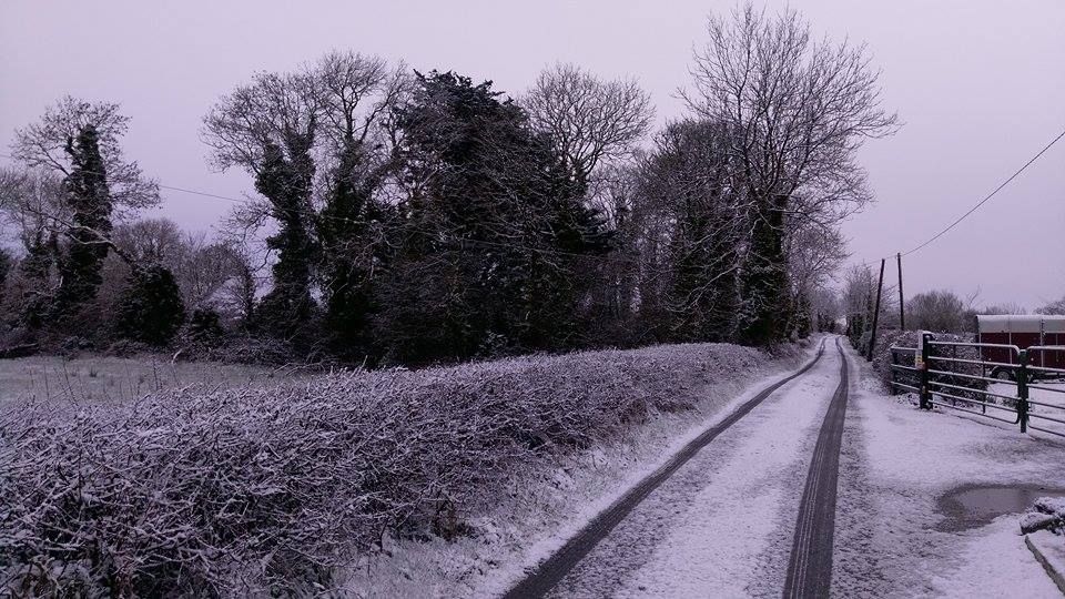
A brief Status Yellow snow-ice warning, issued by Met Eireann at 5:00am this morning, has almost come to an end – finishing at 12:00pm today (Friday, February 9) in a wintry start to this weekend.
Scattered snow showers of up to 3cm of accumulations are expected by Met Eireann; the west and north are expected to be worst hit. It will also be cold this morning with frost and icy patches.
This afternoon, there will be further showers of rain and sleet; however, they will become more isolated. Good spells of sunshine are expected between the showers, almost unbroken in many places.
Tonight will start off mainly dry with clear spells. Frost and icy patches will develop once again soon after dark, with lowest temperatures of -1° to 2° forecast.
At around 12:00am, rain will develop in the west and will spread eastwards to all areas overnight along with fresh, gusty southerly winds bringing a rise in temperatures and clearing any frost.
Despite mainly dry weather forecast over the next few days, there will be only average drying conditions. Spraying opportunities will be very limited due to wind and unsettled periods.
Tomorrow
Tomorrow will be mostly cloudy with outbreaks of rain. Drier intervals will develop for a time during the day. However, persistent and at times heavy rain will spread from the west through the late afternoon and evening with fresh to strong, gusty west to north-west winds. Highest temperatures of 9° to 12° are on the cards.
Tomorrow night will start off wet and windy with persistent or heavy rain and strong, gusty westerly winds, which will veer northwesterly and ease a little as rain clears to the east.
Sunday will be very cold with sunny spells and wintry showers of rain, hail, sleet and snow with a risk of thunder. Highest temperature of just 2° to 6° are given, with moderate to fresh westerly winds.
On Sunday night, wintry showers will continue – with accumulations of snow in places. Frost and icy patches will develop also, with lowest temperatures of -3° to 0°.