Report on Clifden flooding: 'Can satellite radar assist in flood risk warnings?'

Can satellite radar assist in flood risk warnings? According to a recent report by the Irish Centre for High-End Computing (ICHEC), it may be possible.
Using the ‘Corpenicus satellite program’, which is operated by the European Space Agency, several satellites can “routinely monitor land, atmosphere and ocean”, helping to forecast floods.
In its recent report, Dr. Sita Karki, who works as an EO scientist at ICHEC, explained:
“The Sentinel-1 Synthetic Aperture Radar (SAR) satellite mission carries radar sensors capable of observing the earth regardless of weather conditions.
“As such, it provides vital information during the heavy rain and cloudy conditions which are associated with flood events. However, clouds severely impact optical sensors, which cannot provide imagery of satisfactory quality in these conditions.
“From Sentinel-1, we get high-resolution [around 10m] images of the earth every few days over a 250km wide strip.
“Moisture can be monitored around the catchment area and this can help in forecasting floods when integrated with hydrological information such as groundwater levels and stream flow.
In areas where vegetation and peatlands are predominant, like Clifden, regional as well as seasonal moisture trends can be monitored over time.
Dr. Jenny Hanafin, senior EO scientist at ICHEC, said that the satellite gives a regional view, covering wide areas, whereas traditional sensors only measure at one point over time.
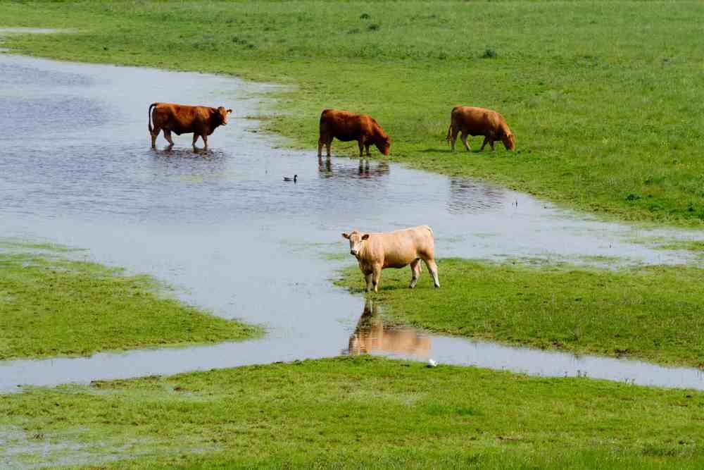
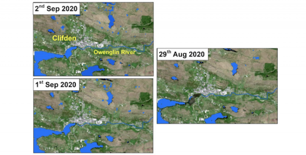
“This ability to monitor large areas is extremely valuable and can be used to map flooded areas, such as the Clifden area, from early September,” she added.
The maps below show the surface of the water on September 1 and 2, along with August 29, as detected by Sentinel-1:
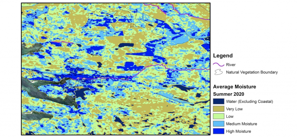
Average soil moisture
The report continues:
“The map below shows the average soil moisture from early summer of 2020. High moisture levels are seen north of Clifden where there is a lot of vegetation.
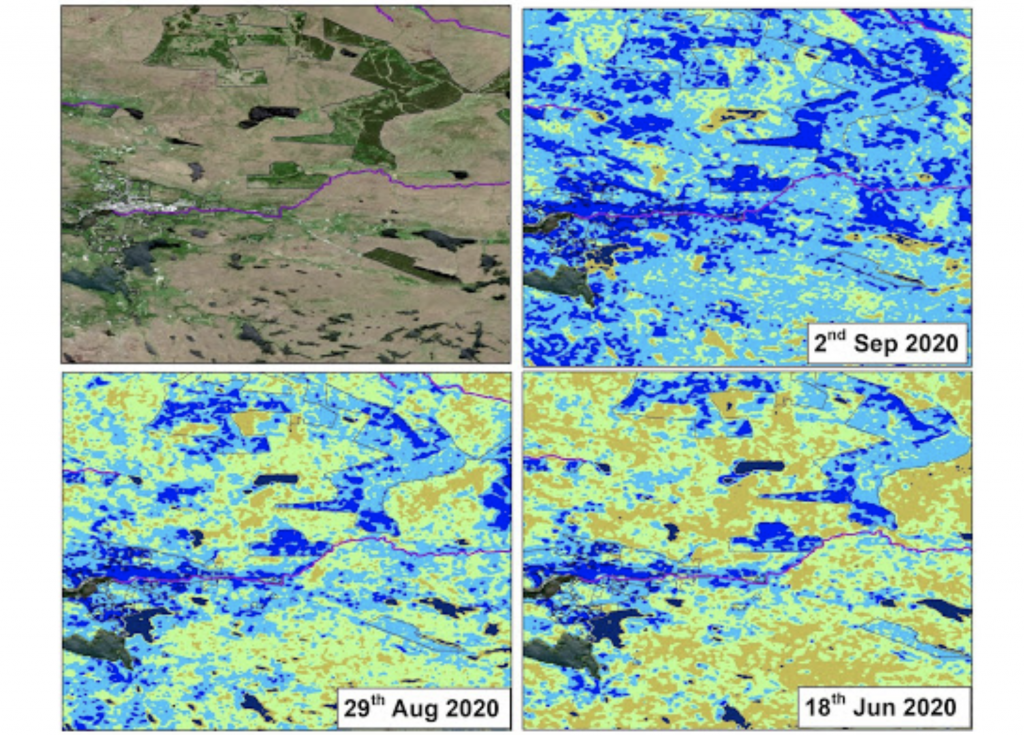
“The figures below show the snapshots of the moisture level in early summer, just before the flood event and just after. The impact of the heavy rainfall on the soil moisture over the whole area is clear, particularly in the Owenglin catchment area.”
The report states that seasonal time series analysis can show the fluctuation of groundwater and its correlation with the local rainfall. This “helps to determine the response time between a rise in groundwater and an increase in stream flow and can help in developing flood forecasting models for the catchment”.
Dr. Karki continued: “With the increase in the frequency of extreme rainfall events due to climate change in Ireland, it is necessary to study regional hydrology as a part of preparedness towards climate change.”
Also commenting on this research, the environmental programme manager at the ICHEC, Alastair McKinstry, said:
The weather event in Clifden was unexpected – locals noted that there was no rainfall warning in place, the rainfall was very localised, both spatially and temporally, the peak of the rainfall and flooding was in approximately three hours.
She added that localised heavy showers are difficult to capture in weather models, but that adding groundwater observations can help give a better understanding of conditions for flood forecasting.