New land-cover map of habitats in development

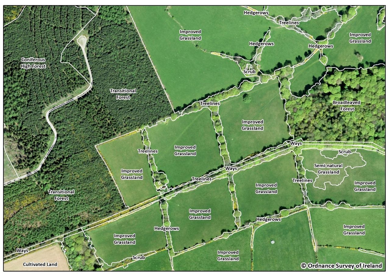
A new national land-cover map of habitats is being developed by the Environmental Protection Agency (EPA) and Ordnance Survey Ireland, and is expected to be complete later this year.
This results of this high-resolution mapping project will be useful for a range of environment-related work concerned with climate change, biodiversity, air quality and water quality.
Co. Wicklow is the first area to be mapped using this approach and the detail and quality of the data are very encouraging, the EPA has said.
Previous land-cover mapping
"The quality of the data in the existing national land-cover map, called CORINE, varies significantly," according to the EPA.
Previous EPA state-of-the-environment reports for Ireland have highlighted the need for more detailed data on land.
Importance
In response, this national land-cover mapping programme commenced in 2018.
The importance of the programme to produce more detailed land cover maps cannot be overstated, it added.

"Once complete, it will transform our understanding of national land cover and land use.
"From an environmental perspective, it will directly improve our understanding of climate change, biodiversity, air quality and water quality and responses to these challenges."
Speaking in the Dáil recently, Minister for Agriculture, Food and the Marine, Charlie McConalogue said it is hoped that the results and long-term implementation of initiatives like this can provide great strides in gathering data on our hedgerow habitats, and more.
"Efforts such as these will be essential in establishing our biodiversity baseline on farms which can benefit the farmer and the environment."