Irish app aims to take 'stress' out of CAP payment queries

A photo app, designed in Ireland, that promises to "take the stress out of Common Agricultural Policy (CAP) grant payment queries" is enjoying success as far afield as Greece, Estonia and Austria according to its developers.
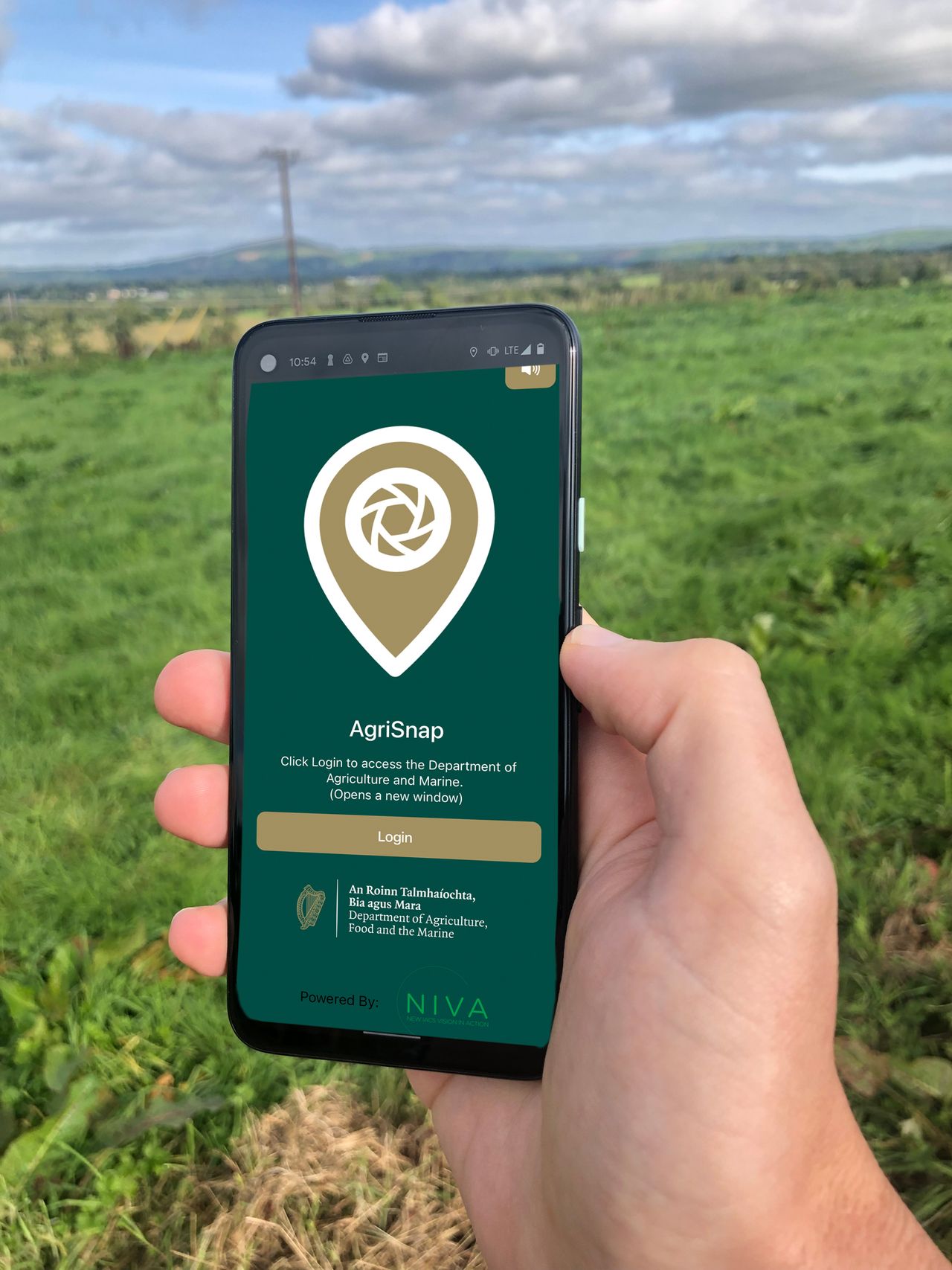
AgriSnap is a precision photo app that allows farmers to send land parcel pictures and information to a grant payments body to validate payments.
It also enables agencies such as the Department of Agriculture, Food and the Marine (DAFM) to send photo requests to farmers and their advisors who can then return images with all of the required information, including geolocation and timestamp.
In the forthcoming CAP 2023 to 2027, agencies such as the DAFM will have to implement an area monitoring system (AMS) to reduce on-the-spot checks (OTSC).
The AMS will include systematic observation, tracking and assessment of agricultural activity using sentinel satellite data or other data such as geotagged photos submitted by farmers as supporting evidence to a claim.
The acceptance of geotagged photos - submitted via for example AgriSnap - as equivalent data is a relatively new development and these images can then be used for many purposes including documenting rapid field visits, to provide information to update land parcel information systems.
AgriSnap
AgriSnap was first rolled out in Ireland by the DAFM in 2021 and to date, more than 100,000 photos have been submitted via the app.
It was initially developed by Waterford’s Walton Institute, in the South East Technological University (SETU) in partnership with a number of stakeholders including the DAFM, Teagasc, farmers and agri-advisors.
The app development project - which received funding from the European Union’s Horizon 2020 programme - was part of an international consortium of 27 project partners that are currently working together to develop and implement technologies to help deliver a more seamless administrative control of the CAP.
The 'IACS Vision in Action' (NIVA) initiative is led by Wageningen University and Research in the Netherlands.
According to NIVA its objective is to facilitate the flow of information to improve agricultural performance and reduce administration burdens for farmers and other agri-stakeholders.
Walton Institute’s Dave Hearne said high-quality GPS data play a key role in validating the information supplied via AgriSnapp.
“Land parcel and request information is available through a map to allow a high-quality user experience. Augmented reality and help functionality also serve to make this a user-friendly app," he said.

Hearne said a number of key features such a photo gallery management and scheme selection menu also make the process easier for users.
When the AgriSnapp was first rolled out in Ireland it was primarily linked to the Results-Based Environment-Agri Pilot Project (REAP) scheme and the Protein Aid Scheme.
DAFM's Stephen Carberry said:
"This resulted in the submission of over 50,000 photos by farmers and advisors. Following its success, the app was subsequently rolled out this year on two additional schemes: The Straw Incorporation Measure and the Agri-Climate Rural Environment Scheme (ACRES)."