University College Dublin’s (UCD’s) School of Agriculture and Food Science hosted a seminar on Wednesday, April 19, titled: ‘Using Drones with Spectral Imaging for Better Crop Management Decisions’.
The seminar, headed up by Prof. Kevin McDonnell of UCD and David Kelly of Capturing a World Ltd, dealt with the lofty topic of using drones in Irish agriculture.
The seminar homed in on the fact that, in order to meet the challenges of larger populations and climate change, more sustainable agricultural production is vital. In order to achieve this, better data – and more of it – is needed.
To this end, tillage land tends to be difficult to gather data from efficiently – due to scale (i.e. large areas to be covered for crop walks and so).
To meet this challenge, drone advocates promise a solution.
Drone technology, despite sounding like a relatively recent phenomenon, has actually been around since the 1980s. The drone itself is only a carrier platform; it is the attached technology that is more important, such as RGB (red, green and blue) cameras, thermal imaging, multi-spectral imaging (capturing images at specific frequencies across the electromagnetic spectrum) and hyper-spectral imaging (gathering data from across the electromagnetic spectrum).
Drones equipped with multi-spectral cameras are used to assess various information such as crop health, storm damage, fertilizer application examination and for research purposes.
David Kelly explained the usefulness of such technology. He said: “We use either RGB cameras or multi-spectral cameras that are suitable for determining agricultural indices, such as normalized difference vegetative index (NDVI).
The benefit of these indices is that they can give a quick overview of the condition of a field. This can be interpreted by an agronomist. The data can be used to determine prescriptions for fertilizer applications and so on.
“In France, for instance, this has seen wheat fields show 10-15% increases in yield, when prescriptions have been determined by aerial mapping.”
Explaining the usual procedure for a run over a crop, Kelly noted that a flight takes an average of about 30-40 minutes depending on field size, as well as two to three hours to process the data.
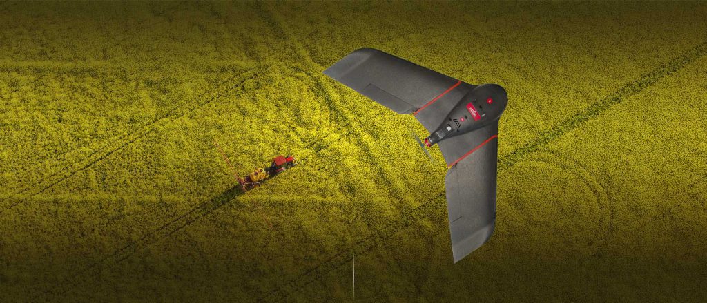
The type of drone used by Capturing a World is a fixed-wing eBee, manufactured by Sensefly in Switzerland. The multi-spectral camera is manufactured by Airinov in France, which also claims to be a “major force” in the use of drones in agriculture.

This is not a stealth bomber. It’s actually a small fixed-wing drone, which is being used to ‘scan’ crops
Capturing a World Ltd was formed in 2014 as an aerial imaging company. Since then, it has geared up to provide data for several client types – such as agriculture, forestry, surveyors and archaeology. The company is based in Newbridge, Co. Kildare, but reaches out across the whole of the Republic of Ireland.
