Met Éireann: Unsettled conditions to continue this week


Met Éireann has said that the weather over coming week will continue to be unsettled with showers and rain, but it will feel milder, particularly at night.
The national meteorological service said that there will be some heavy downpours at times and rainfall amounts will be between 1.5 and 3 times higher than normal. The wettest conditions are expected in the southeast and west.
Mean temperatures are expected to be between normal and 2°C above normal, ranging from 9 to 11°, soil temperatures will remain above normal.
A Status Yellow rainfall warning for counties Carlow; Kilkenny; Wexford; Wicklow and Waterford will remain in force until midnight tonight.
A similar warning has been issued for Co. Cork which is valid until 7:00p.m today (Monday, April 8).
The heavy rain will potentially lead to flooding, poor visibility and difficult travelling conditions.
Met Éireann
The forecast for today shows that rain and drizzle will extend to most areas, staying dry in some western coastal counties where there will be some showers.
The rain will continue for most of the days in the south, east and midlands, the heaviest falls will be in the southeast.
The north to northwest winds will strengthen in southern and southwestern coastal parts. Highest temperatures of 5 to 10°.
The rain will gradually clear overnight into the Irish Sea to leave clear spells and scattered showers. Overnight lows of 2 to 6° in moderate to fresh northwest winds.
Tuesday (April 9) will be a mainly dry day with sunny spells, moderate to fresh northwesterly winds and highest temperatures of 8 to 12°.
Rain will develop in the southwest on Tuesday night and will push into most parts as the night progresses. The southerly winds will be moderate to fresh. Lowest temperatures of 2 to 6°, milder in the southwest.
Wednesday (April 10) will be dull with rain and drizzle for much of the day, highest afternoon temperatures of 12 to 15° in a moderate to fresh southwesterly breeze.
The rain will clear eastwards on Wednesday night followed by scattered showers. It will be mild with overnight temperatures of 10 to 12°, the southwesterly winds will ease.
It will be dry on Thursday (April 11) with sunny spells and the odd shower. Cloud will thicken in the southwest bringing rain by evening. Highest temperatures of 13 to 18° in a light to moderate southwesterly breeze.
There will be more rain on Friday (April 12), the heaviest falls in the northwest. Highest temperatures of 12 to 17°.
The current outlook for the weekend is for conditions to become cooler with further spells of rain.

Met Éireann has said that drying conditions will be generally moderate to poor this week because of the frequent showers and rain.
The best opportunities for drying will be on Tuesday as it looks to be a mostly dry day with moderate to fresh northwest winds.
Opportunities for spraying will be limited over the next seven days due to showers and spells of rain and often windy or breezy conditions.
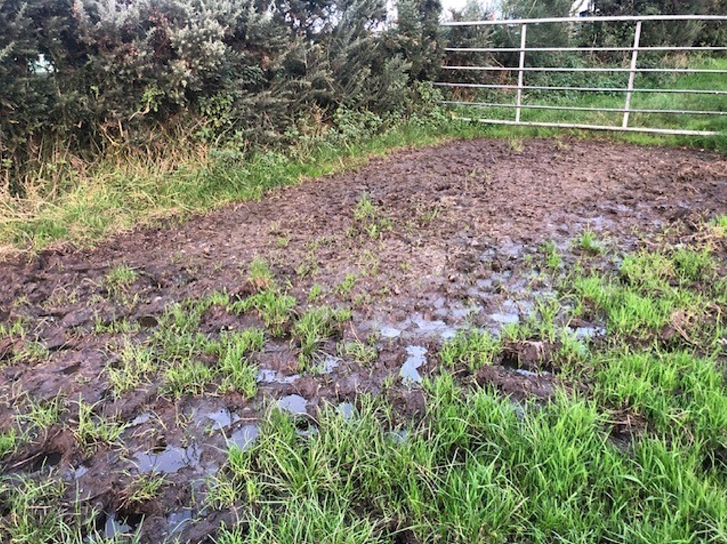
Well drained soils are currently saturated, moderately drained soils are either saturated or waterlogged and all poorly drained soils are waterlogged at the moment.
Over the coming week there will be little change as wetter than normal weather will bring no respite. Trafficability will continue to be very poor.